Back Second Thomas Shoal German Second Thomas Shoal English Banco de arena Ayungin Spanish Banc Second Thomas French セカンド・トーマス礁 Japanese 세컨드 토마스 숄 Korean Second Thomas Shoal Swedish Buhanginan ng Ayungin Tagalog Bãi Cỏ Mây Vietnamese 仁爱礁 Chinese
 Second Thomas Shoal | |
| Heograpiya | |
|---|---|
| Kinamumugtakan | South China Sea |
| Tagboan | 9°44′N 115°52′E / 9.733°N 115.867°ETagboan: 9°44′N 115°52′E / 9.733°N 115.867°E |
| Arkipelago/Kaiislahan | Spratly Islands |
| Administrasyon | |
| Region | Southwestern Tagalog Region |
| Province | Palawan |
| Municipality | Kalayaan |
Warning: Page using Template:Infobox islands with unknown parameter "disputed" (this message is shown only in preview).
Warning: Page using Template:Infobox islands with unknown parameter "type" (this message is shown only in preview).
Warning: Page using Template:Infobox islands with unknown parameter "other_names" (this message is shown only in preview).
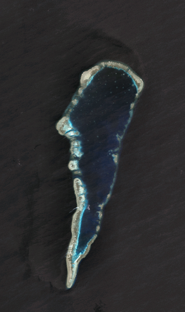
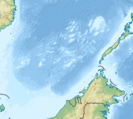
An Ayungin Shoal, inapod man sa Ingles Second Thomas Shoal (Filipino: Kulumpol ng Ayungin, lit. 'Cluster of [the] silver perch'; Vietnamese: Bãi Cỏ Mây; asin sa Mandarin Chinese: 仁愛礁/仁爱礁; pinyin: Rén'ài Jiāo),[1] sarong atoll sa Spratly Islands kan West Philippines Sea, 105 nautical miles (194 km; 121 mi) bandang sulnopan kan Palawan, Filipinas.[2] Pighihingako kan magkapirang mga nasyon alagad ini yaon sa eklusibong ekonomikong sona kan Filipinas,[3] an atoll sa presente okupado militarmente kan Filipinas.
- ↑ Sailing Directions - South China Sea. Taunton: UK Hydrographic Office.
- ↑ Sailing Directions Enroute : Publication 158 - Philippine Islands. Springfield, Virginia: US National Geospatial-Intelligence Agency (NGA). 2013.
- ↑ "TOPIC: Sierra Madre, Second Thomas Shoal, and the U.S. Commitment to Defense of the Philippines" (PDF). pacom.mil. February 23, 2023.
© MMXXIII Rich X Search. We shall prevail. All rights reserved. Rich X Search
